Victoria Falls . They are a waterfall of the Zambezi River located on the border of Zambia and Zimbabwe .
Location
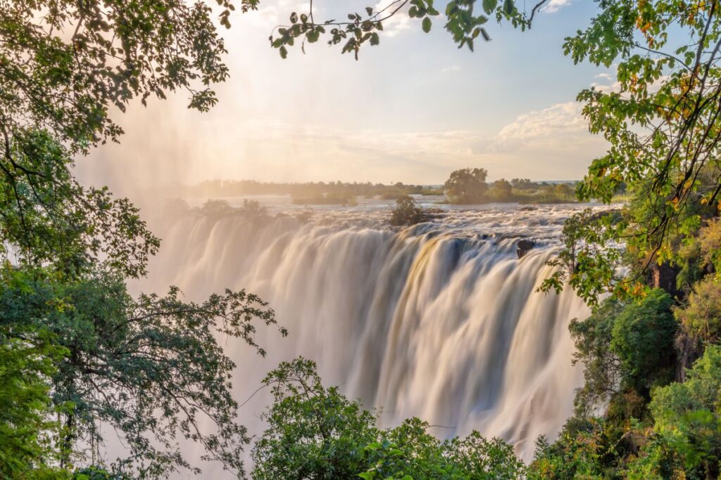
They are located in the district of Livingstone in Southern Province (Zambia) in Zambia and in the district of Hwange , in the region of Mashonaland West , from Zimbabwe . They are approximately 1.7 km wide and 108 m high. They are considered an extraordinary spectacle due to the narrow and rare abyss into which the water falls. In such a way that the fall can be seen with the naked eye.
David Livingstone , the Scottish explorer , visited the waterfall in 1855 and named them after Queen Victoria , although they are known locally as Mosi-oa-Tunya , the smoke that thunders . The waterfall is part of two national parks, Mosi-oa-Tunya National Park in Zambia and Victoria Falls National Park in Zimbabwe , and they are one of the biggest tourist attractions in southern Africa . They have been declared a World Heritage Site by UNESCO , in 1989. Covering the protected area an area of 8,780 km.
Starting in 2010 , Victoria Falls will be integrated into the Kavango-Zambezi Conservation Area .
Origin
The falls are formed by the plummeting in a single vertical of a chasm between 60 and 120 m wide, sculpted by its waters along a basalt plateau. The depth of the chasm, called the First Gorge, varies between 80 m in its westernmost part to 108 meters in the center. The only exit from the First Gorge is a 110 m wide space about two-thirds of the way across the width of the falls from the west, through which the entire volume of the river falls into the gorges from Victoria Falls.
The plateau along the Zambezi River experiences a rainy season from late November to early April, and a dry season the rest of the year. The annual flood takes place between February and May with a peak in April .
The water sprayed from the waterfalls reaches 400 meters and even 800 meters depending on the season. However, during the flood period it is not possible to see the foot of the waterfall or part of the curtain of the waterfall, in addition the walks along the cliff turn out to be a constant shower due to the abundant vaporized water. Near the edge of the cliff, water vapor rises like reverse rain, especially on the edge of Zambia.
As the dry season enters, the peaks become wider and more numerous, from September to January more than half of the face of the falls can become dry and the First Gorge can be seen over almost its entire length. At this station it is possible, although not necessarily safe, to walk along some of the river’s crests. It is also possible to hike from the bottom of the First Gorge to the Zimbabwe part .
The lowest flow occurs in November , and is one-tenth that of April; This variation in flow is also greater than in other large waterfalls and makes the annual average flow of the Victoria Falls less than expected when compared to the maximum.
The Victoria is almost twice the size of Niagara Falls , and more than twice the size of the Horseshoe Falls ( Canada ). They only rival the Iguazu Falls in South America .
Devil’s Pool
Between September and December, due to the low water levels, it is possible to swim safely, at the edge of the falls in this natural pool that can be accessed through Livingstone Island. This strange place is called Devil’s Pool , in Spanish, the Devil’s Pool .
It is an additional attraction to the already incredible view of Victoria Falls, which can only be enjoyed in the low-flow season, since otherwise bathers would be swept away by the waterfall.
It is located 100 meters from the bottom of the falls, it is not the largest pool in the world, but it is one of the most dangerous.
River floods can be so fast that in a matter of minutes the flow can rise up to 1 meter.